This subproject investigates the interactions of climate and glaciers in the Alps on a centennial time scale. The project is led by Madlene Pfeiffer, Ben Marzeion and Inga Labuhn from the Institute of Geography, University of Bremen.
Glaciers are typically located in complex terrain, which interacts strongly with the atmospheric processes governing the energy and mass balances of a glacier. That is why glaciers constitute an important link between the atmosphere and their terrestrial environment. An understanding of these interactions is necessary to investigate the impacts of climate change in alpine geosystems and therefore provides a starting point for the overarching objective of the SEHAG Research Unit.
Because of their high mountain locations, glaciers experience an expression of large scale weather and climate patterns which is strongly influenced by the local conditions, especially topography. These local conditions, however, are not well represented in climate data from observations, reanalyses or models. The subproject CLIMATE aims at model-based reconstructions of local climate variability and the consequent glacier changes. This allow to connect any changes in geosystem dynamics, which are investigated in the other SEHAG subprojects, to the underlying atmospheric forcing. At the same time, we quantify how much of the total uncertainty in glacier reconstructions comes from inherent glacier model errors, and how much from inadequate climate data.
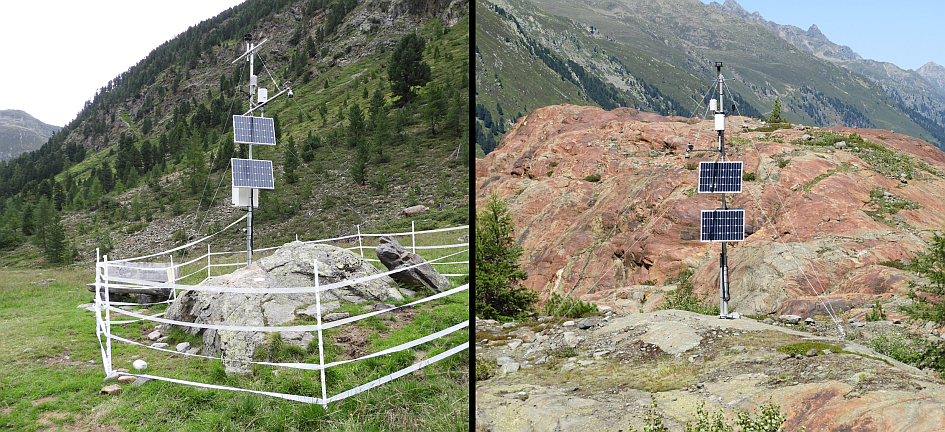
- Using the „Weather Research and Forecasting Model“ (WRF), we perform downscaling experiments of an ensemble of global reanalysis data sets to build temporally and spatially highly resolved data sets of the atmospheric state over the Alps. These data sets represent small scale climate processes which are relevant for the geosystem, and especially for the glacier dynamics. The data sets are validated using point observations of existing weather stations and stations we set up at the SEHAG study sites (Figure 1).
- Using the Open Global Glacier Model (OGGM), we reconstruct the evolution of glacier mass balances, runoff, ice flow and geometry of all glaciers in the study area, including those which are no longer existing. The underlying causes of glacier changes are studied through sensitivity analyses.
- We quantify in how far the uncertainty in glacier reconstructions can be reduced by forcing the model with downscaled atmospheric data. We achieve this by repeating the glacier reconstruction and its validation using the results of the different steps in the downscaling procedure.
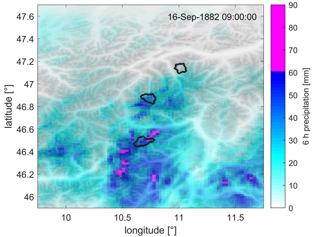
First investigations have shown that dynamical downscaling of global reanalysis data can capture local weather phenomena through a better representation of the detailed topography. As expected, the location of modeled convective cells does not match exactly with observations, because their spatial patterns are determined by stochastic processes in the atmosphere. Nevertheless, their timing and magnitude are well represented in the model, e.g. the precipitation event leading to the flood and landslide catastrophe in the fall of 1882 (Figure 2).