The members of the SEHAG research group met for this year’s field meeting in the Kaunertal valley.
After the working groups arrived at the common accommodation at noon on June 28, the first task was maintenance work on the climate station. The time was also used to discuss vegetation development and formation dynamics on the right lateral moraines of the Gepatschferner glacier. In parallel, members of the Eichstätt working group acquired aerial imagery of the Fernergrieß with the new RTK drone; the images will be used for new mapping and digital elevation models in this subarea.
On the second day, the group met Dr. Johannes Schöber from TIWAG, who showed us the measuring equipment at the Gepatschalm gauge, and with whom we exchanged views on the research work in the SEHAG project.
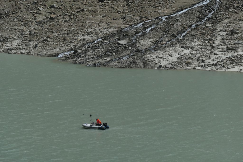
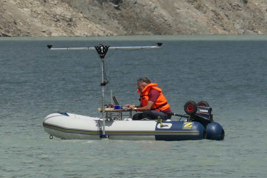
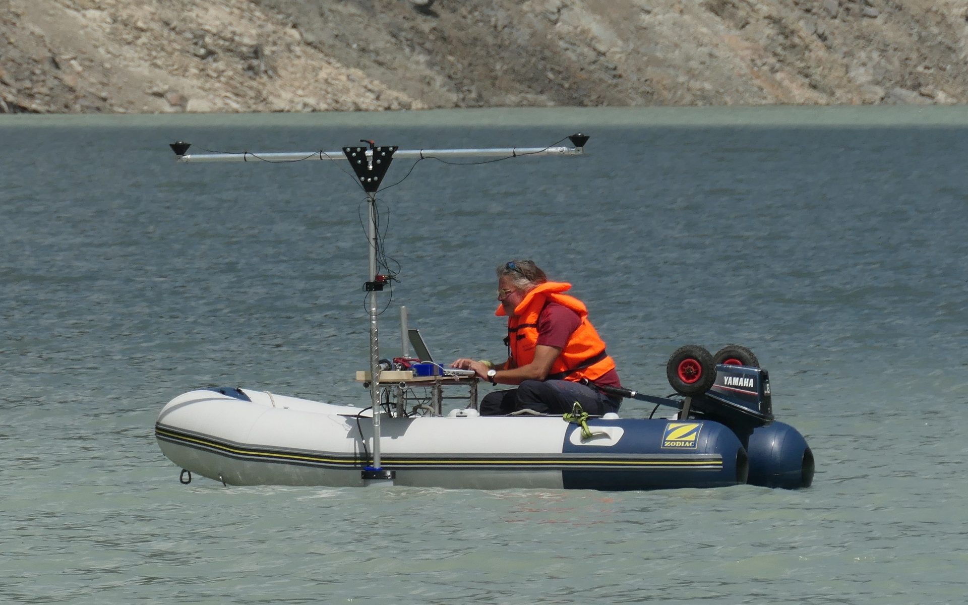
Everybody was then excited to witness the first test measurements with the new NORBIT multibeam echo sounder of the Eichstätt working group. This had been successfully applied for and purchased with the second phase of SEHAG in order to be able to determine the depth and characteristics of a lake or sea bed or of a river bed with high resolution and accuracy. The test measurement was preceded by extensive preparatory work such as the construction of mounts and the assembly of the technology for the precise localization of the measuring equipment using GPS and inertial sensors. Florian Haas, who had carried out all this work over the past weeks, launched the inflatable boat on the morning of June 30. The test measurement was successful, as the first look at the data showed. Like the point clouds from the airborne LiDAR survey, these now need to be processed until we can view and analyze a detailed underwater terrain model. In combination with the terrain surface before the construction of the Gepatschstausee, these data will allow, for example, the quantification of the sediment volume deposited in the lake since commissioning of the dam, and the average annual sediment load from the catchment area, where the subprojects of the SEHAG research group want to detect, understand and in the future also predict climate change impacts.
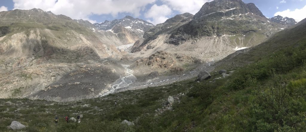
The second day was also used for installation and maintenance work on the hydrological measuring equipment of the Munich SEHAG subproject and for a visit to the glacier front of the Gepatschferner. Again and again it becomes apparent that mapping and modeling should best be complemented with terrain observations…
On the last day, due to the weather, the group retreated to the meeting room at the hotel and discussed the upcoming field work, future meetings and the plan to publish the main results of the SEHAG research group in an open-access publication.