
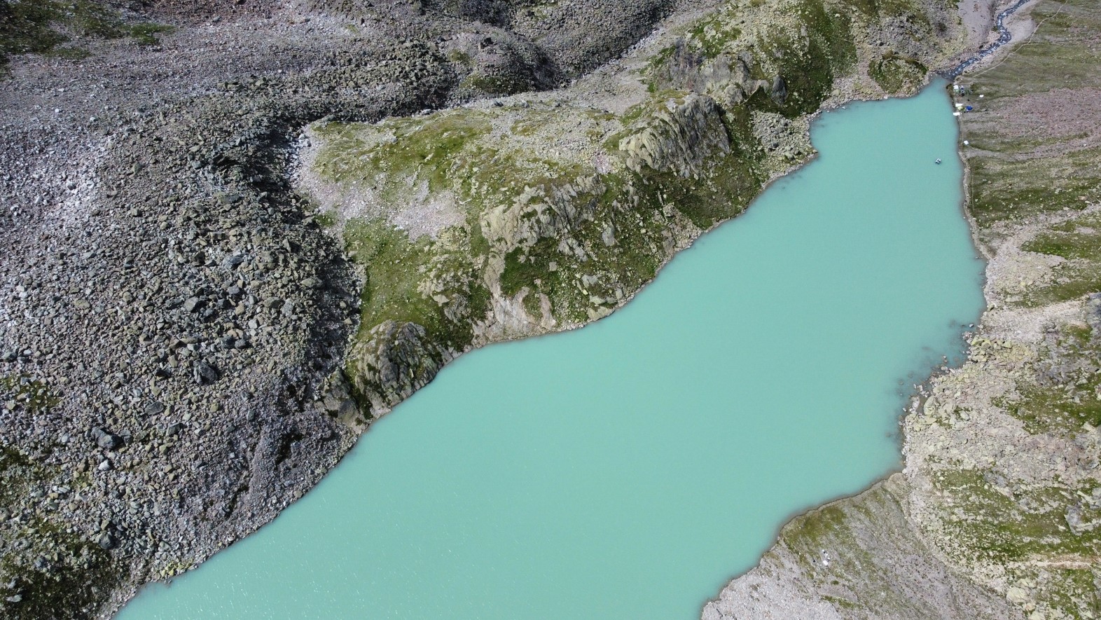
In August 2024, the SEHAG Group set up a research camp in the Horlachtal for several days to carry out various surveys at and on Lake Grastal (2500 metres above sea level).
Using sonar technology (sound navigation and ranging), the lake bed of the Grastalsee was surveyed in order to subsequently analyse the underwater topography and the corresponding sediment input. The corresponding technology was installed on a boat, with which the lake bed could be surveyed with centimetre precision in around three hours.
Several channel sections of the Grastal stream above and below the Grastalsee were also surveyed using UAV aerial photography in order to be able to generate digital elevation models. In comparison to earlier models, corresponding changes are to be determined.
Another aim of the camp was to use a rainfall system to simulate various precipitation events on an active debris cone resulting from the LIA glacier forefield of the Grastalferner and reaching into the Grastalsee. For this purpose, different areas with different durations of sedimentation (e.g. between 1997 and 2006 as well as 2021 and 2022) were irrigated. The aim is to investigate the different erosion activity of these younger and older deposits.
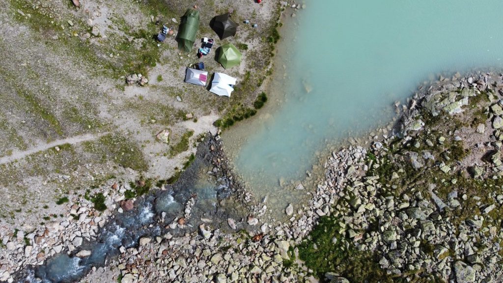
Camping ground at Grastalsee.
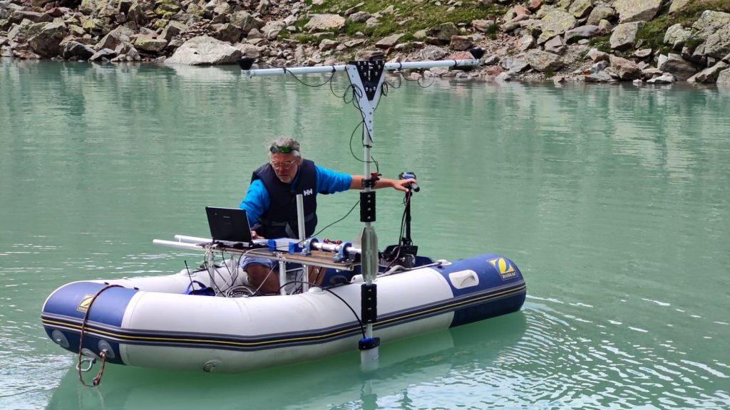
Survey on the Grastalsee with the sonar-equipped boat.
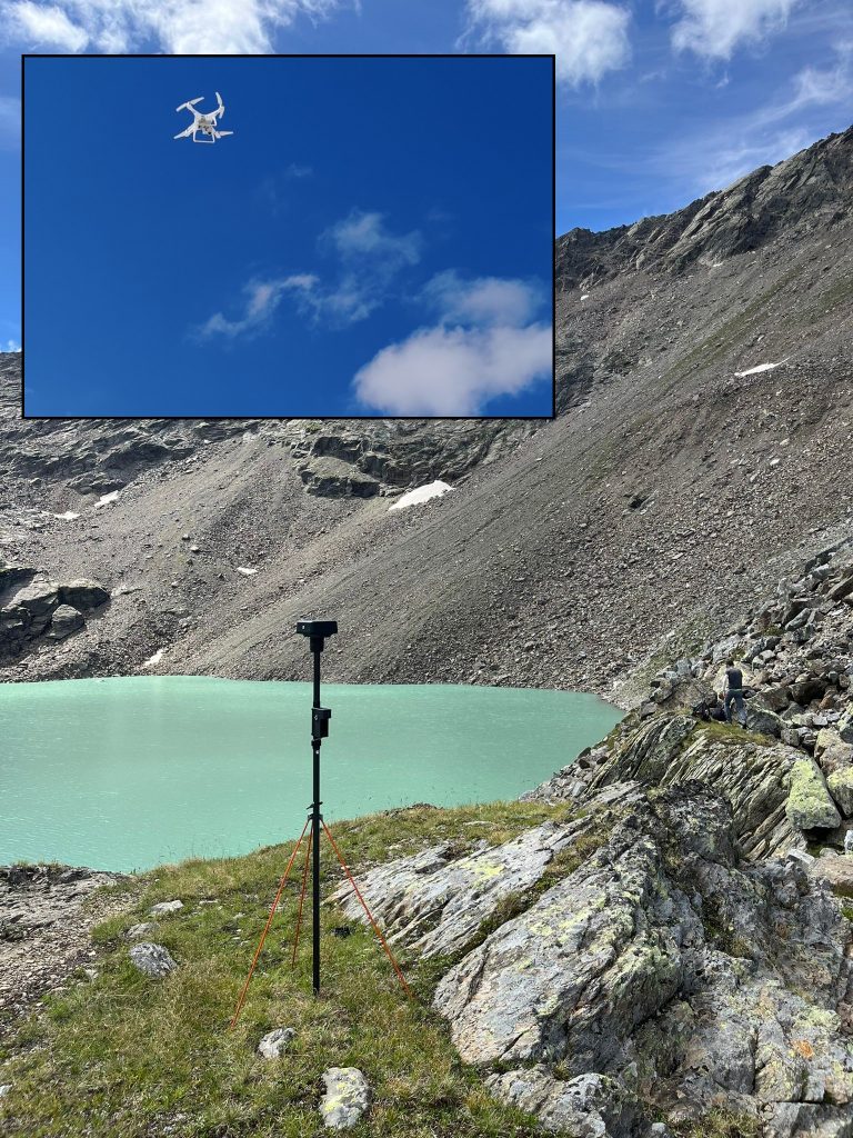
UAV surveying.
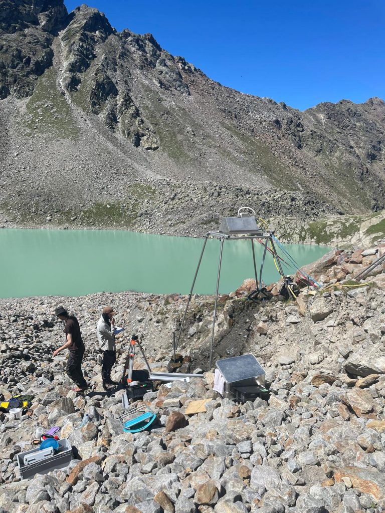
Working on the rainfall system on the debris cone extending into the Grastalsee.
Transport of the work material by helicopter.