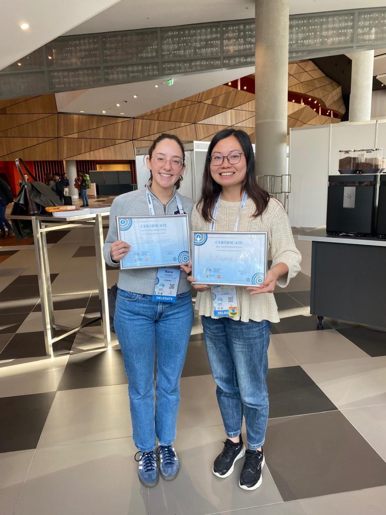
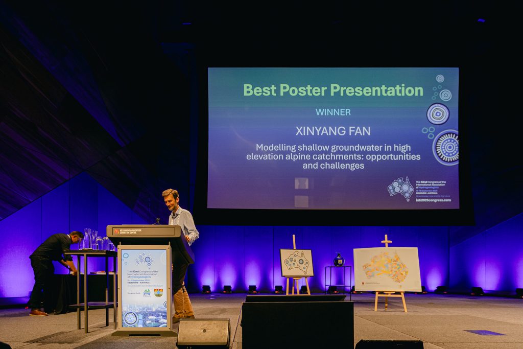
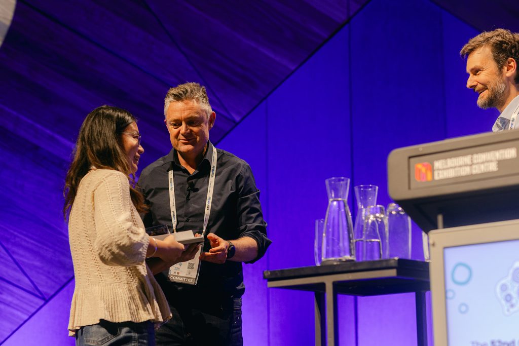
Dr. Xinyang Fan (FAU Erlangen/Uni Bern) was awarded the Best Poster Presentation by the International Association of Hydrogeologists (IAH) at the World Groundwater Congress 2025 in Melbourne, Australia. Her work, “Modelling shallow groundwater in high-elevation alpine catchments: opportunities and challenges”, was recognized for valuable new insights into groundwater and discharge dynamics in the high-elevation glaciated landscapes. It highlights both the potential and complexities of physics-based hydrological modeling in such sensitive environments. This prize emphasizes the significance of investigating and understanding the changes in the high alpine geosystems under the impact of climate change.
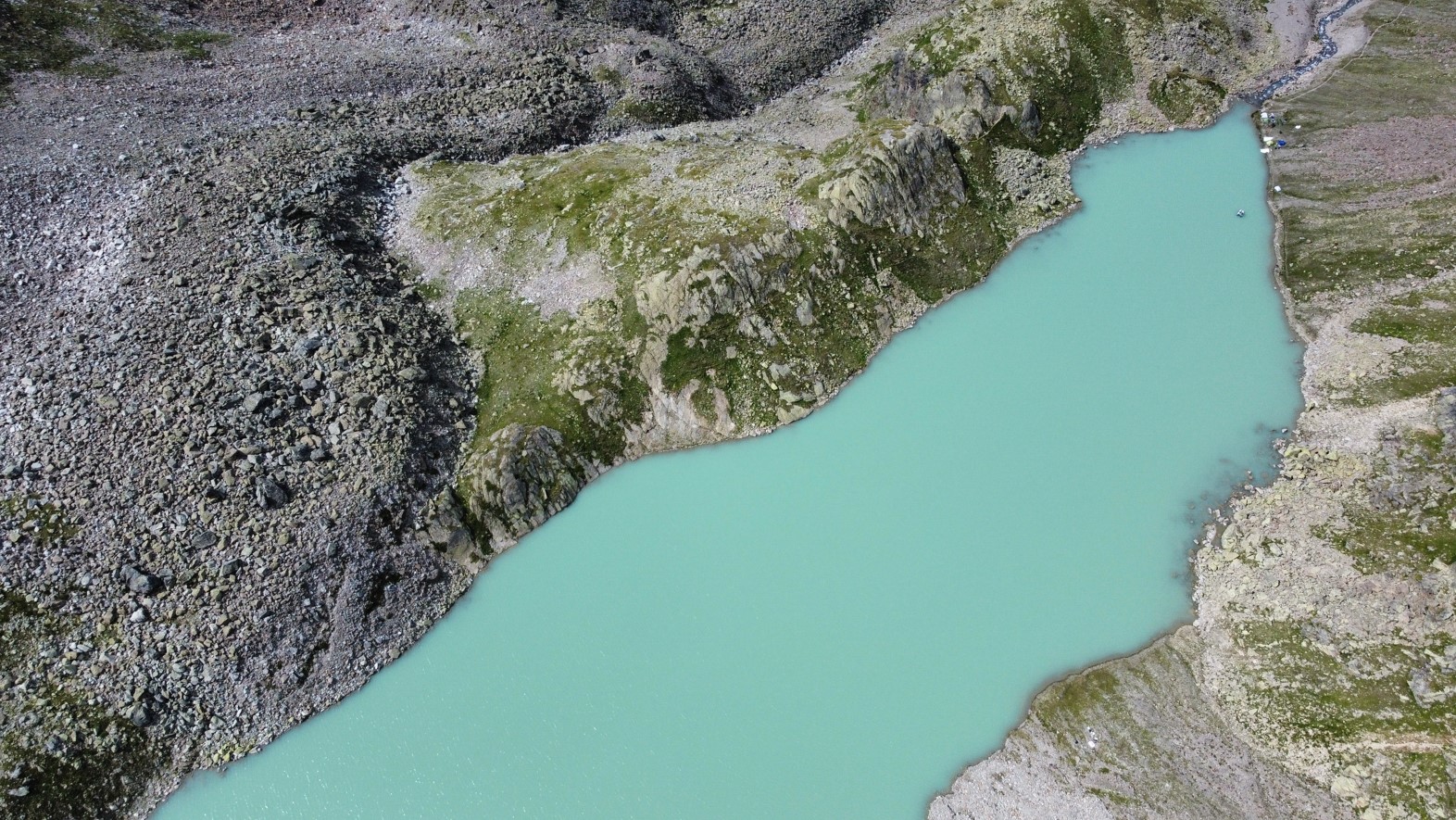
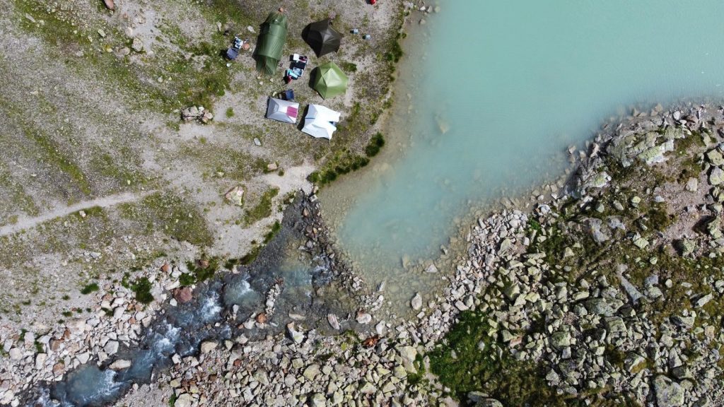
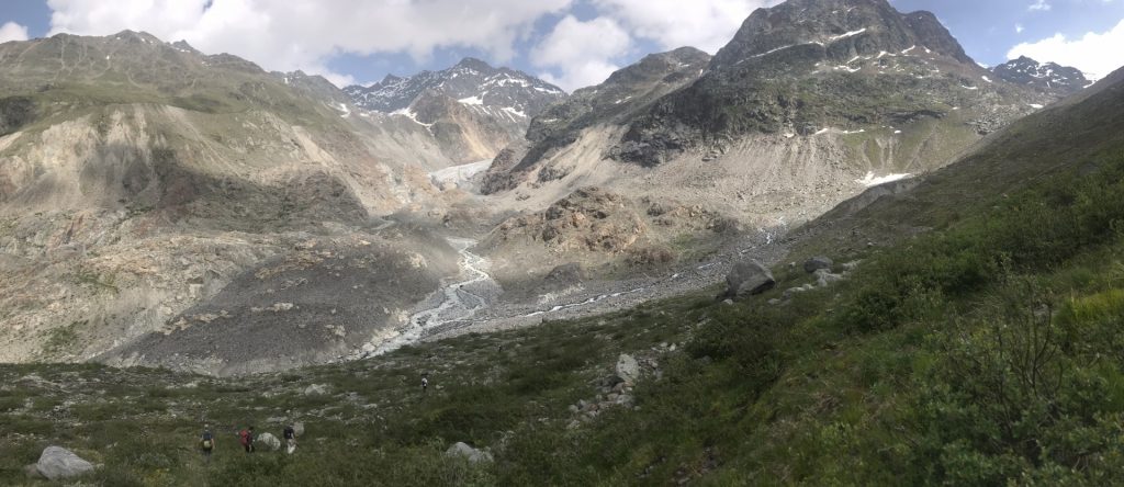
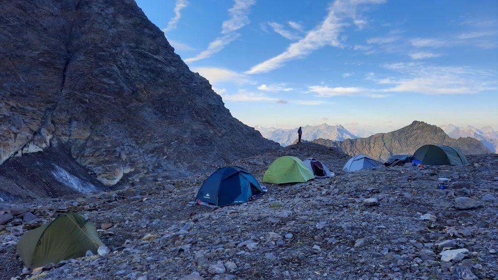
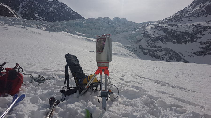
In August 2024, the SEHAG Group set up a research camp in the Horlachtal for several days to carry out various surveys at and on Lake Grastal (2500 metres above sea level).
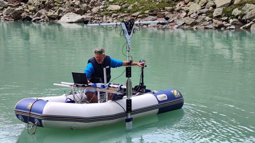
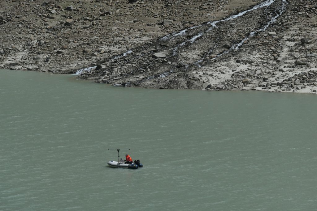
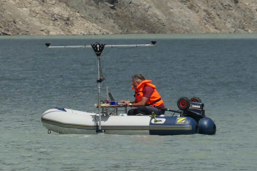
Using sonar technology (sound navigation and ranging), the lake bed of the Grastalsee was surveyed in order to subsequently analyse the underwater topography and the corresponding sediment input. The corresponding technology was installed on a boat, with which the lake bed could be surveyed with centimetre precision in around three hours.
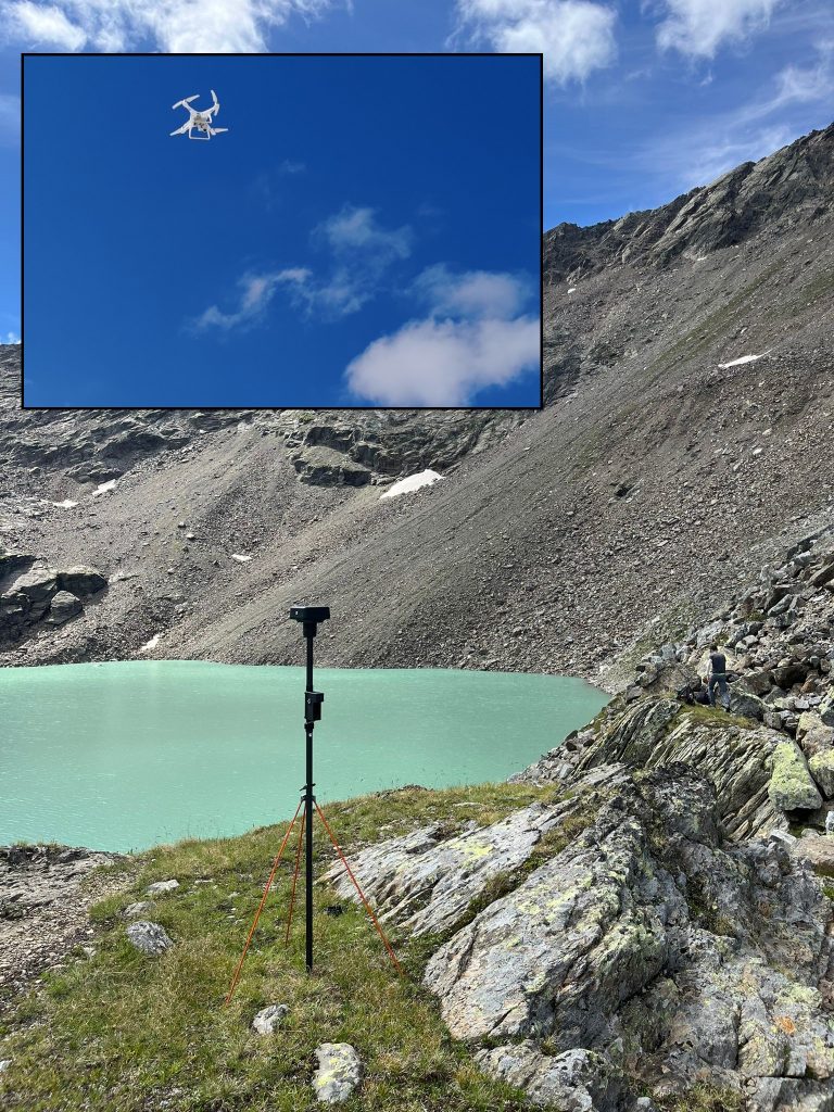
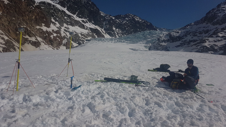
Several channel sections of the Grastal stream above and below the Grastalsee were also surveyed using UAV aerial photography in order to be able to generate digital elevation models. In comparison to earlier models, corresponding changes are to be determined.
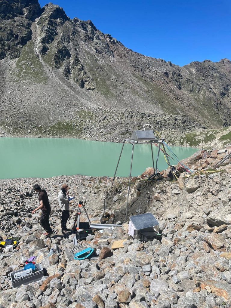
Another aim of the camp was to use a rainfall system to simulate various precipitation events on an active debris cone resulting from the LIA glacier forefield of the Grastalferner and reaching into the Grastalsee. For this purpose, different areas with different durations of sedimentation (e.g. between 1997 and 2006 as well as 2021 and 2022) were irrigated. The aim is to investigate the different erosion activity of these younger and older deposits.
Camping ground at Grastalsee.
Survey on the Grastalsee with the sonar-equipped boat.
UAV surveying.
Working on the rainfall system on the debris cone extending into the Grastalsee.
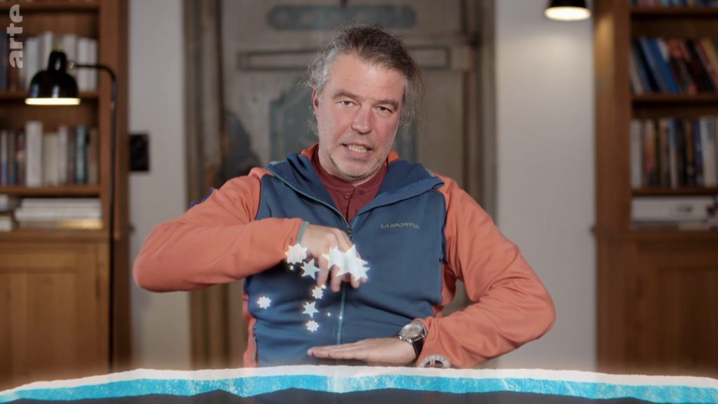
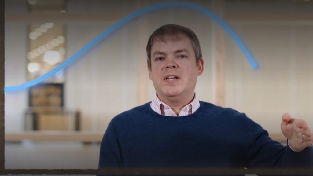
In their research, members of the SEHAG research unit are investigating the manifestations of climate change in the Alps since the end of the „Little Ice Age“ and its consequences for water balance, vegetation and the shaping of landforms. Recently, Ben Marzeion and Florian Haas, project leaders of subprojects 1 (climate and glaciers) and 3 (geomorphological processes on hillslopes), respectively, were interviewed by the authors of the ARTE documentary series „42 – the answer to almost everything“.
Together with glaciologist Angelika Humbert (Alfred Wegener Institute), they explain the findings of science around the formation and properties of glaciers and their response to climate change. A good example of science communication, in our opinion!
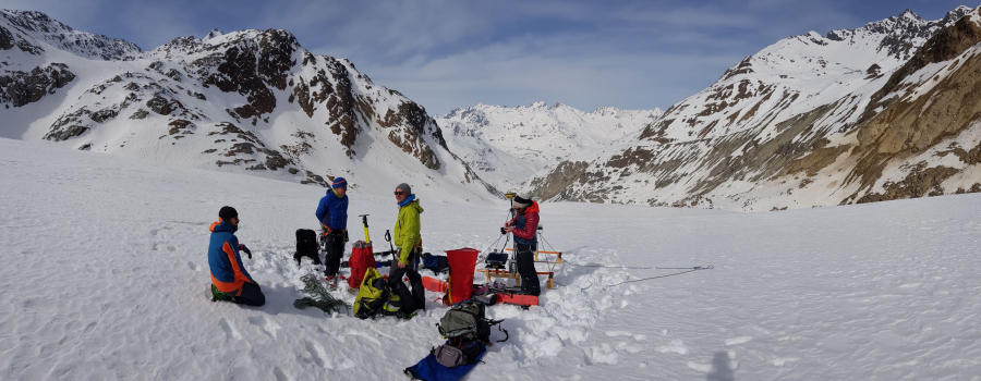
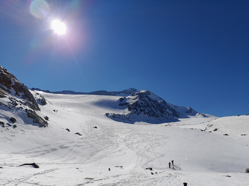
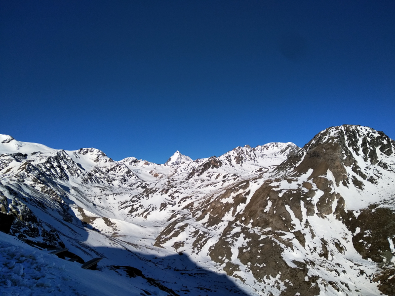
The members of the SEHAG research group met for this year’s field meeting in the Kaunertal valley.
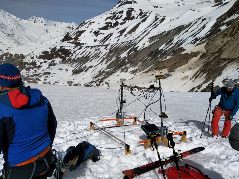
After the working groups arrived at the common accommodation at noon on June 28, the first task was maintenance work on the climate station. The time was also used to discuss vegetation development and formation dynamics on the right lateral moraines of the Gepatschferner glacier. In parallel, members of the Eichstätt working group acquired aerial imagery of the Fernergrieß with the new RTK drone; the images will be used for new mapping and digital elevation models in this subarea.
On the second day, the group met Dr. Johannes Schöber from TIWAG, who showed us the measuring equipment at the Gepatschalm gauge, and with whom we exchanged views on the research work in the SEHAG project.
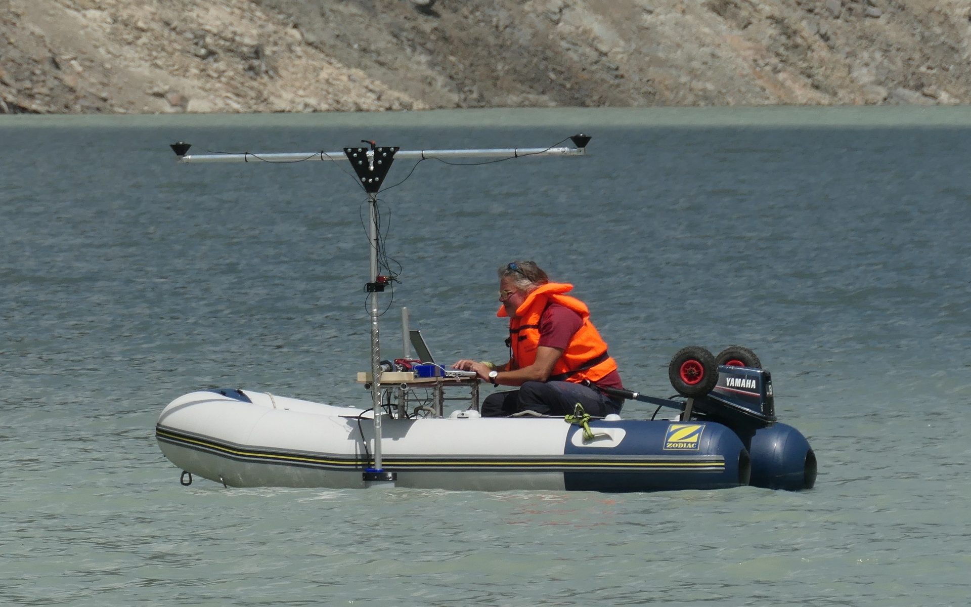
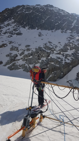
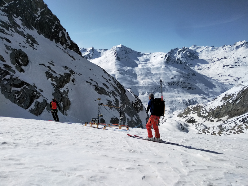
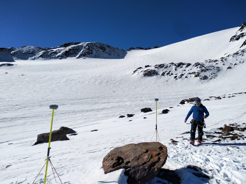
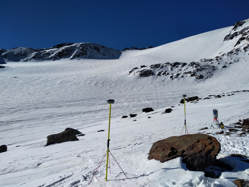
Everybody was then excited to witness the first test measurements with the new NORBIT multibeam echo sounder of the Eichstätt working group. This had been successfully applied for and purchased with the second phase of SEHAG in order to be able to determine the depth and characteristics of a lake or sea bed or of a river bed with high resolution and accuracy. The test measurement was preceded by extensive preparatory work such as the construction of mounts and the assembly of the technology for the precise localization of the measuring equipment using GPS and inertial sensors. Florian Haas, who had carried out all this work over the past weeks, launched the inflatable boat on the morning of June 30. The test measurement was successful, as the first look at the data showed. Like the point clouds from the airborne LiDAR survey, these now need to be processed until we can view and analyze a detailed underwater terrain model. In combination with the terrain surface before the construction of the Gepatschstausee, these data will allow, for example, the quantification of the sediment volume deposited in the lake since commissioning of the dam, and the average annual sediment load from the catchment area, where the subprojects of the SEHAG research group want to detect, understand and in the future also predict climate change impacts.
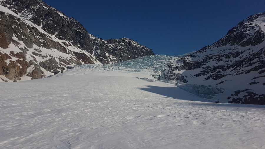
The second day was also used for installation and maintenance work on the hydrological measuring equipment of the Munich SEHAG subproject and for a visit to the glacier front of the Gepatschferner. Again and again it becomes apparent that mapping and modeling should best be complemented with terrain observations…
On the last day, due to the weather, the group retreated to the meeting room at the hotel and discussed the upcoming field work, future meetings and the plan to publish the main results of the SEHAG research group in an open-access publication.
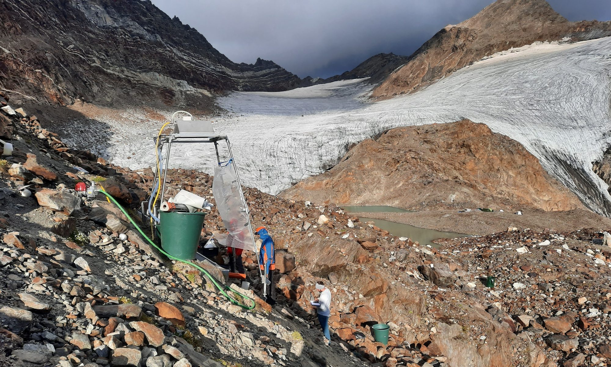
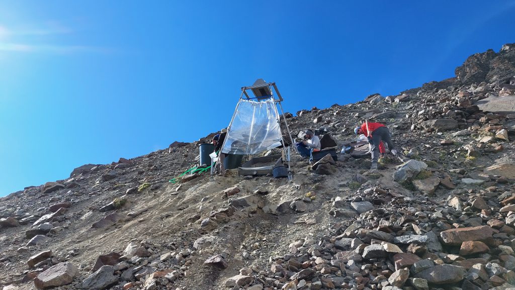
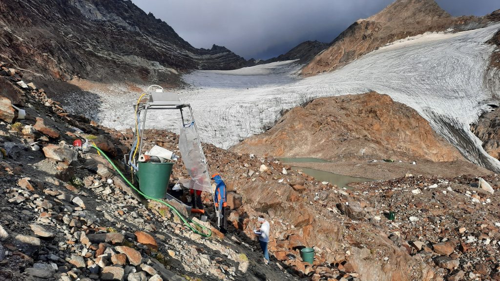
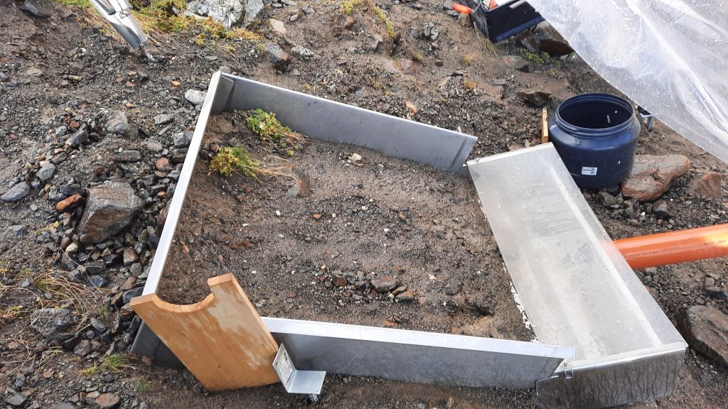
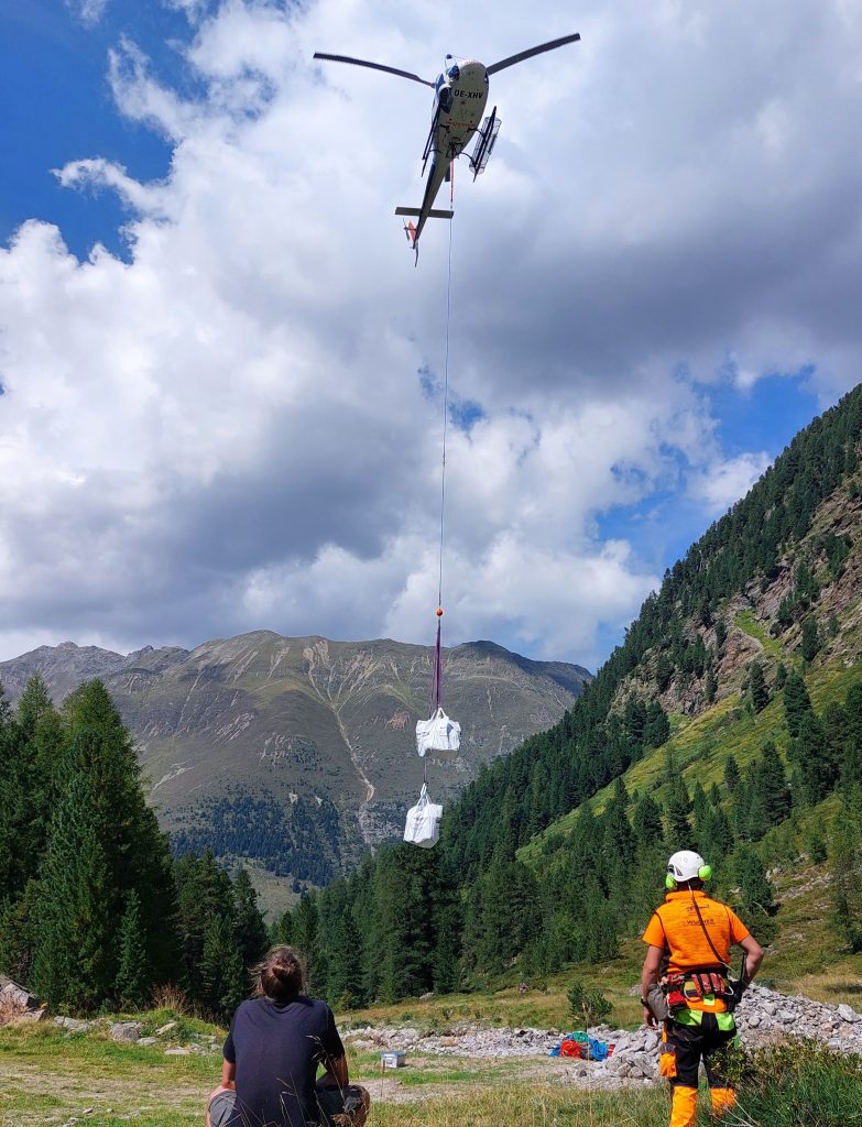
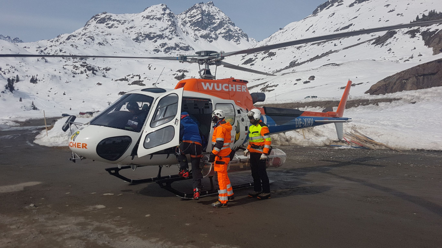
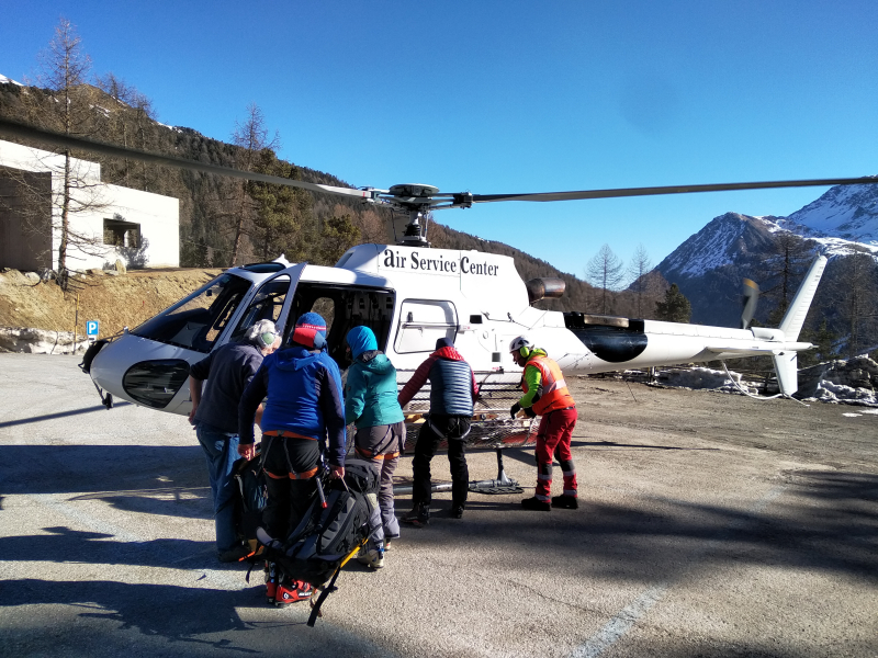
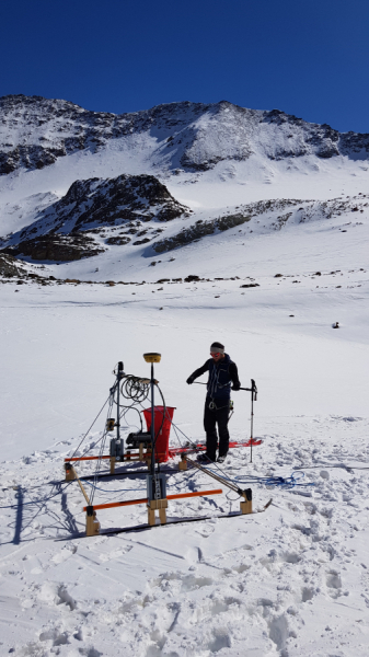
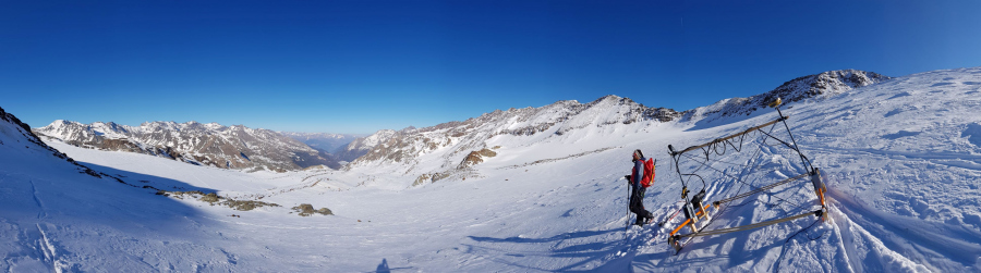
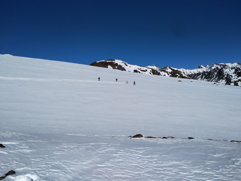
In mid-August 2022, a research visit lasting several days was carried out in the Horlachtal in the glacier forefield of the Grastalferner at an altitude of approx. 2900 metres above sea level. Dr Peter Fischer (Department of Soil Geography & Soil Erosion at KU), Moritz Altmann, Jakob Rom, Fabian Fleischer, Eva Schien and Christian Sender were involved in this field campaign as scientific staff. Using a rainfall simulation system and the Erosion3D model, the fluvial erosion patterns of these areas are to be simulated. The aim was therefore to carry out various rainfall simulations on the loose material of the lateral moraine and to take corresponding soil physical parameters, which then have to be analysed in the laboratory for the modelling. The measurements lasted one hour each, with a rainfall intensity of 40 mm per hour, which corresponds to a heavy rainfall event. The area of interest of one square metre was photogrammetrically recorded both before and after the rainfall simulation in order to determine corresponding erosion processes using a DEM of difference (DoD). Using prognosticated precipitation data up to 2050, the future morphodynamics of these areas are to be estimated. The rainfall simulation system was transported to the glacier forefield by helicopter due to its weight and the difficult accessibility of the terrain.
Setting up the rainfall simulation system on a steep slope.Carrying out the rainfall simulation.Area of interest during the rainfall simulation.Transport of the rainfall simulation system into the glacier forefield of the Grastalferner.The camp during sunrise.
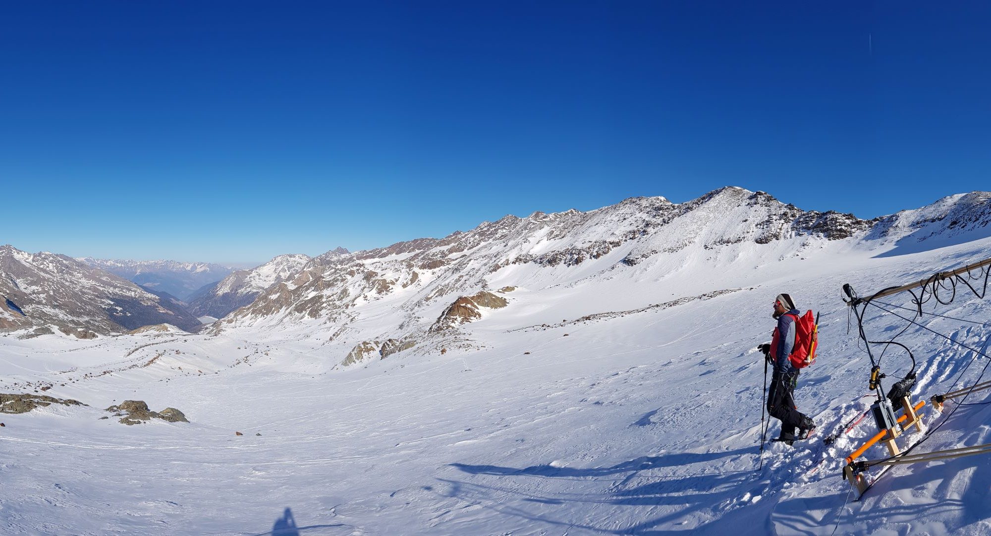
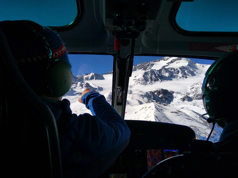
In March, field work was carried out on the Weisssee-, Gepatsch-, Zufall- and Fürkele-glaciers in the Kaunertal and Martelltal valleys as part of the research project SEHAG. The aim was to record the topography under the glaciers in order to obtain a picture of the future mountain landscape today. Scientists from the KU Eichstätt-Ingolstadt, the Institute for Interdisciplinary Mountain Research of the Austrian Academy of Sciences (ÖAW, Kay Helfricht and Martin Stocker-Waldhuber) and the Institute for Alpine Environment at Eurac Research jointly carried out georadar measurements and terrestrial laser scans on site. The people and material involved were brought to the measurement site by helicopter due to the remote location and the heavy weight. The area was surveyed that is expected to be ice-free by 2050. The data help the scientists to model the processes that will take place in the future and to make better forecasts.
Our follow-up applications were successful ! SEHAG is going to continue research for the next three years. During the second phase of our project, we will not only further improve our knowledge and understanding of past geosystem changes but will also focus on the future (until the year 2050). For both aims, we will utilise computer models, not only regarding meteorological forcing (for the reconstruction of past climate and projections of future development, depending on emission scenarios) but also regarding glacier melt, runoff formation, evolution of landforms and vegetation.
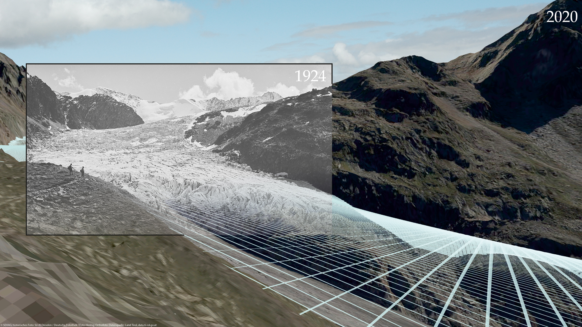
This year’s edition of the DFG calendar focuses on the topic „Digitalisation“ and presents 12 DFG-funded projects that use digital processes in their work. The photo submitted by the SEHAG Group as part of a competition represents the month of March.
The image shows a historical photo (from 1924) that has been positioned over a current orthophoto from 2020 and a digital elevation model using photogrammetric methods by determining the exact location of the photographer at that time. The modelled glacier surface from 1924 shows the strong changes of the Gepatschferner in the Kaunertal. The glacier has lost a thickness of about 100 metres at this point. The length of the glacier has decreased by about 2 kilometres since 1924.
How can a complicated scientific question be presented in 90 seconds? That was the task for the doctoral students and postdocs of the Catholic University of Eichstätt-Ingolstadt at this year’s Young Researcher Day 2021. This day was aimed at all doctoral students and postdocs at KU with various offers, such as scientific career planning. The task was to present the own research project in a short video. The winners were the three doctoral students Moritz Altmann, Jakob Rom and Fabian Fleischer from the SEHAG subproject Hillslope processes. The video shows the journey from Eichstätt to one of the study areas, the geomorphological slope processes to be studied, the various ways of measuring the earth’s surface, the processing of historical digital elevation models and several successive shaded elevation models that make the dynamics of the slope processes visible. The results show firstly the high geomorphological activity and instability of a recently deglaciated lateral moraine and secondly the acceleration of a rock glacier that we have observed since the 1990s.
The winner’s video can be viewed on the Facebook page of the University of Eichstätt-Ingolstadt.
Since the TV premiere on 20.09.2021, the documentary “ Rettung für die Alpen – Unterwegs mit Felix Neureuther“ can be seen on the channels of National Geographic. In conversation with many experts, climate change in the Alpine region is illuminated and the consequences it has for the geosystems in the high mountains are shown. As part of the filming, Felix Neureuther was also a guest at the Catholic University of Eichstätt-Ingolstadt. Florian Haas and his team presented the research activities of the SEHAG research group and showed how changes in the high alpine geosystems can be derived from historical maps and historical photographs.
An excerpt from the documentary, in which Felix Neureuther is a guest in Eichstätt, can be viewed HERE on the Youtube channel of National Geographic Germany (video is in German).